 ZYRNTOPO
Topographic mapping and navigation for the field.
Save an area before you leave. Maps, terrain, tracks and field tools keep working on the device with no signal, on Android, Windows, Linux and in the browser.
Features
Maps
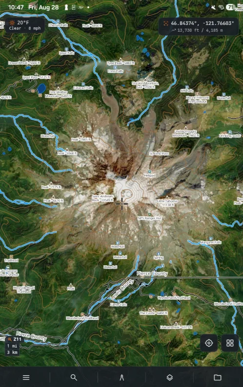
16 base layers — topographic, satellite, hybrid, nautical and land-status overlays. Vector and raster tiles.
Navigation
GPS position, track recording, routes, waypoints, bearings and distance. MGRS, UTM and latitude/longitude.
Terrain
3D terrain, elevation profiles, slope shading, aspect, viewshed and radio line-of-sight.
Offline
Select an area, download its tiles and terrain, and keep them on the device. Storage is persistent — the system will not reclaim it.
Drawing and measurement
Lines, polygons, markers and freehand annotation. Area and distance, in metric or imperial units.
Team
Shared positions, markers and tracks over the internet, over a local network, or through a TAK server you run yourself.
Data
Import and export GPX, KML/KMZ, GeoJSON and CSV. Print a true-scale map sheet for the pack.
Privacy
No advertising and no third-party trackers. Map data stays on the device unless you sync it.
Platforms


Pricing
Free
$0
- Offline maps and 16 base layers
- GPS, tracks and navigation
- Draw, measure and markers
- 3D terrain, viewshed and PDF map sheets
- Unlimited offline downloads
- GPX, GeoJSON, KML and CSV
- No account required
Pro
$50 once · or $2.99/mo
- Team Sync — shared live map and chat
- ATAK, TAK server and MAVLink bridges
- The power lines overlay
- One licence on all four platforms
- Buy once and it never expires — no renewal, no seat count